Fig. 3
Download original image
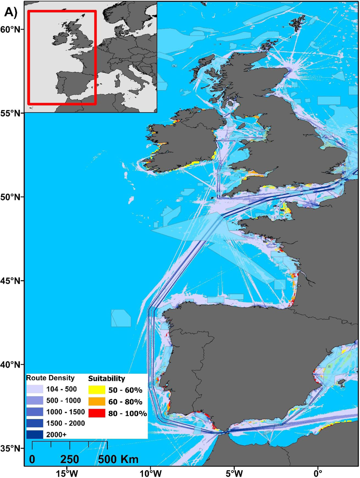
A) Suitable habitats after adding MPA data (in blue; UNEP-WCMC & IUCN, 2022), shipping route density within the Atlantic Area (EMODnet Human Activities, 2022) and excluding sites with <20m depth. The areas of highest suitability are shown to be in more southern latitudes. B) Spain, Portugal and western France, including harbour size and location data. C) Northern France, Ireland and the UK, including harbour data.
Current usage metrics show cumulative count of Article Views (full-text article views including HTML views, PDF and ePub downloads, according to the available data) and Abstracts Views on Vision4Press platform.
Data correspond to usage on the plateform after 2015. The current usage metrics is available 48-96 hours after online publication and is updated daily on week days.
Initial download of the metrics may take a while.