Fig. 1
Download original image
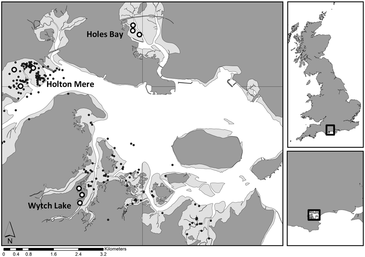
Approximate locations sampled by pump-scoop dredge for the clam stock assessment in June 2015 and revisited in January 2016 (white circles). The northern-most site is Holes Bay (closed site), the westerly site is the area around Holton Mere (high intensity fishing), and the southerly site is Wytch Lake (low intensity fishing). The small black circles indicate SIFCA fishing sightings during 2015. Sampling locations in Wytch Lake are within the intertidal. The locations in the UK and on the UK's south coast are inset.
Current usage metrics show cumulative count of Article Views (full-text article views including HTML views, PDF and ePub downloads, according to the available data) and Abstracts Views on Vision4Press platform.
Data correspond to usage on the plateform after 2015. The current usage metrics is available 48-96 hours after online publication and is updated daily on week days.
Initial download of the metrics may take a while.